 |
 |

|
|||
| |

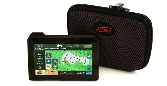
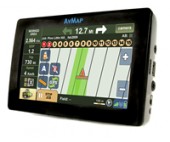
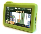
G6 Connect Farmnavigator
The most complete GPS solution for intelligent agriculture
G6 Connect Farmnavigator is born from the partnership between AvMap, the Italian leader in GPS navigation since 1994 and Satconsystem, the specialist in high-tech tools for the agriculture.
That’s why G6 Connect Farmnavigator is the most complete GPS solution.
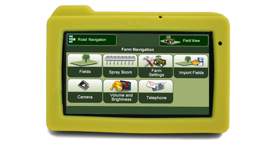
Farm Navigation
• Ligthbar navigation with parallel and contour tracking
• Sprayboom virtual switch command
• Field perimeter and field area measurement
• Soil sample positioning for Field Surveying
• Jobs and fields database in Google Earth™ format
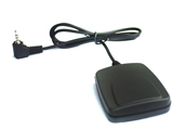
• 4hz DGPS receiver
GSM - GPRS Phone
• Hands free calls
• SMS messaging
• Vehicle management tools
Road navigation
• 100% portable with built-in GPS receiver
• European maps
• Turn-by-turn vocal instructions
• Trip computer
• Lane Assistant
• Built-in alcohol tester
Precision Farming functions
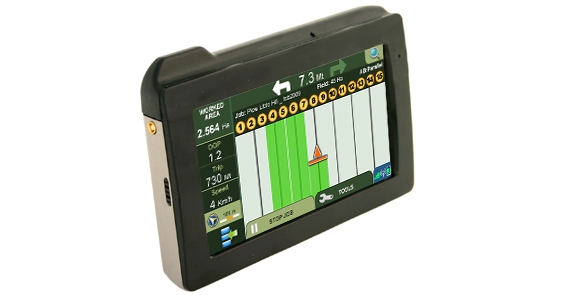
Virtual spray boom commander
G6 Farmnavigator calculates the area that has already been treated and thanks to the virtual spray boom commander helps you saving chemical products, reducing costs and minimizing the environmental impact of your operations. You can set up the number of spray boom sections (up to 15 sections) and their length. After setting the sections you will see on the display which spray boom section has to be switched off to avoid overlapping. If the boom section is over an area that has already been treated, the section will be highlighted on the screen to warn that it has to be switched off, vice versa it will show when a section has to be opened again. This warnings are very useful when making a U turn or when trying to avoid an obstacle. The Virtual Boom section commander works in parallel mode, contour and Tramline mode!
Guiding lines: Parallel and Contour
You can easily set the tramlines for your operations choosing among parallel, contour guidelines or existing tramlines.
Parallel Tracking
In the Parallel Tracking mode, G6 Farmnavigator creates parallel tramlines on the screen along which you can drive. Press A to start and B to end: on the display the AB segment will be traced together with its parallel segments.
Contour Tracking
In the Contour Tracking mode, you can create the first tramline in a curved field, by pressing A to start and B to end, then this tramline will be replicated over the whole field.
Existing Tramlines Tracking
In fields with existing tramlines or planted with row crops, you can switch the Farmnavigator to the Tramline mode. In this mode there is no navigation bar, but you can see the real time green track and it can be used to work with the virtual sprayboom switch.
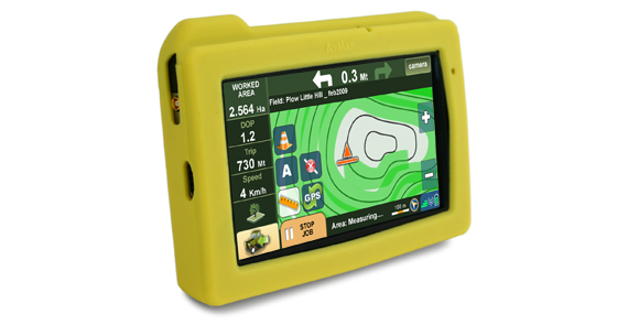
Lightbar Navigation
According to the set tramlines, the Lightbar will show the driver if and how much the vehicle is off the track so that he can adjust the trajectory at any time.
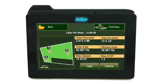
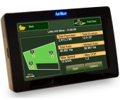
Perimeter and Area Measurement
To calculate the perimeter of a field you are working on, just touch the Measure button to start and touch it again to close the measurement. The perimeter and area will be saved in the Job file.
Measuring Obstacles
During the navigation, you can save a mark point to signal obstacles or soil sample positions. The mark points will be saved in the job file.
Jobs Database
When you start a new job, all its data (perimeter, area, treated area, obstacles, timing, maximum DOP and maximum speed) will be saved in a database. The job can be paused and estarted at any moment. You can see a data sheet for each job and you can export the database in the Google Maps™ format so that you can view it in Google Maps™ or Google Earth™.
Visit: http://www.farmnavigator.com
Customer Support
 |
|
 |
|
| User Manuals | |
| FAQ |
 Warranty
AvMap GPS are guaranteed for 2 years after the purchase date.
| Products you may like |
 |
Terrestrial Products: |